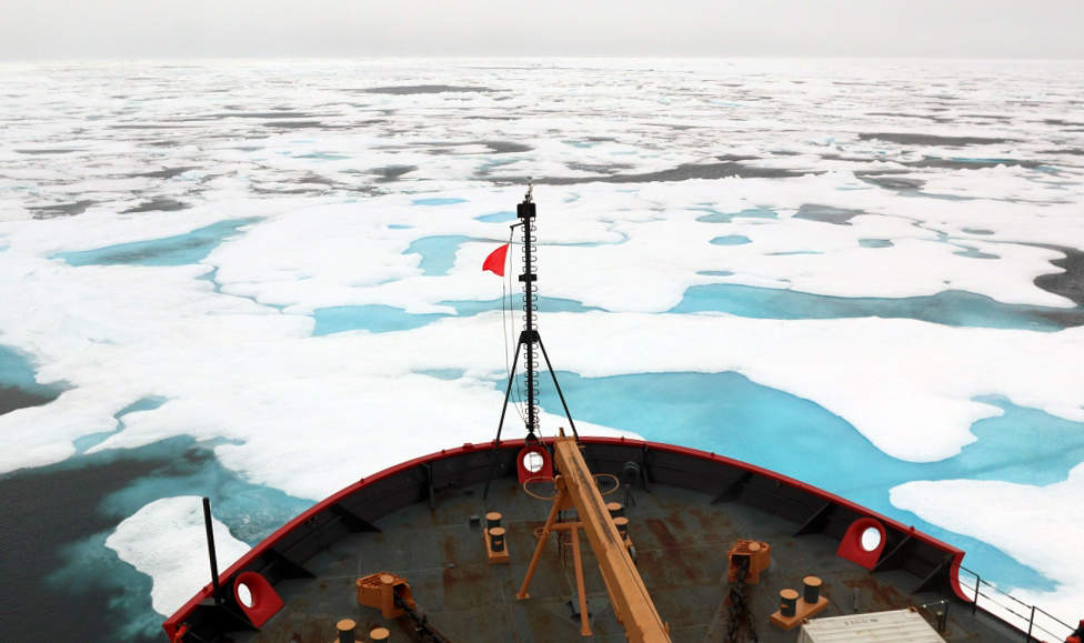
As global warming continues, the world’s ice is on the move and worrying the offshore oil and gas industry. Floating ice can cause major damage to platforms and rigs, and the people who work on them. To tackle this problem, Rutter, Statoil Canada and the Government of Newfoundland and Labrador have collaborated on a new remote sensing technology to automatically detect and track moving ice.
The tracker, which is integrated into Rutter’s Sigma S6 software, can act as an early warning system to oil platforms, letting them know well in advance if floating ice is on its way and prepare for impact.
As more of the ice caps disappear into the sea, oil and gas companies must adapt to ensure the safety of their operations. Tracking the movement of ice looks set to be a key part of that, but how does it work?
Warmer waters and more ice
Floating ice has been a threat to oil and gas platforms for decades, but with ice melting faster than ever before this threat continues to grow. Between 1976 and 2006 summer melting of ice in Greenland increased by 30%, whilst in Antarctica water temperatures have increased by 2.5°C since 1950.
“With global warming you’re seeing more ice floating through than we have seen in previous years,” says Rutter’s vice president Blair Wheaton. This increased activity has brought to the forefront the challenge of monitoring the movement of ice within cold, harsh waters.
In July, an iceberg the size of Delaware broke off Antarctica’s Larsen C ice shelf and floated out into the South Atlantic. This collapse followed similar events on Larsen A and B, where cracks also led to large icebergs being set adrift as the ice shelfs broke down.
“The Antarctic Peninsula has been one of the fastest warming places on the planet throughout the latter half of the 20th century,” said Colorado State University glaciologist Dan McGrath. “This warming has driven really profound environmental changes, including the collapse of Larsen A and B.”
With warming waters these events are becoming more frequent, and the risk to offshore oil and gas operations is increasing. “Ice can cause severe damage; if you’re talking about platforms that are removing oil from the ocean floor, ice could damage the platform or move it off of its position,” says Wheaton. “Then you could have a major oil leak for one, not to mention the safety of the personnel on board. So ice can do severe damage.”
In addition to the platforms currently at risk, the melting of Arctic ice has led to an increased interest in oil exploration in the Arctic. Vessels can now travel through previously impossible areas, and this has encouraged a number of countries, including Canada, the US and Norway, to offer exploration and drilling leases within Arctic waters.
Tracking ice
The tracker technology developed by Rutter, Statoil and the Canadian government can automatically identify ice floes, pans, ridges, icebergs embedded in pack ice, and open water leads. It then tracks their movement, and predicts the drift route they will follow using advanced radar systems and high-resolution imaging to monitor the area surrounding a platform 24 hours a day.
“We’ve had a tracker for quite a number of years but we enhanced the technology we used to make it more sophisticated to better track ice and other targets,” says Wheaton.
There were a number of challenges involved in developing the software, capable of automatically assessing which ice is a hazard within an icy environment.
“Just trying to make the right software package for what they call false calls, to make sure that when the system detects something, it is 100% reliable,” says Wheaton. “With our system now you can take into account the shape of the object and determine for sure that it is an iceberg and not anything else like a small vessel. This system ensures that we can tell one from the other. Also with the system’s ability to integrate a sophisticated camera, we can also zoom in on the target identified.”
What to do when ice is on its way
The tracker allows companies to prepare for oncoming ice in a number of ways. “There are other companies around that are designed to remove icebergs, so we could inform those people and they remove them,” says Wheaton. “[This] could be in the form of nets, large nets that they cast over the icebergs and haul them away. Sometimes they can use vessels to manoeuvre around the icebergs to change their direction.”
However, due to the size and speed of the ice, this isn’t always possible. In such situations, the safety of the crew and the environment takes precedence. “If you determine that you cannot stop the direction of the ice, you can actually make a decision on whether you need to evacuate the platform or not,” says Wheaton. “The system allows the operators to make good operational decisions that enhances safety.”
In such an event, the oil and gas can be locked in to avoid possible spills if the platform is damaged or moved when the ice hits. The tracker also ensures there is ample time to remove all those working on the platform; as such even if the tracker cannot stop the ice, it can stop anyone getting hurt.
Wheaton is confident that Rutter’s tracker will be rolled out across not just platforms but also vessels in the near future.
“Our team is surveying the field test, and evaluating what came of that to see if there are any minor changes that we need to make in that, and then go forwards from there,” says Wheaton.


